ArchNova

Federal Fragmentation

At ArchNova, we believe that AI is best suited for helping us with monotonous and tedious jobs.  We don’t want AI to take anyone’s job or remove creativity, art, or culture from what we do.  Instead, we are designing our AI to help us save time and money to be able to do more of what we want to do – the exciting analytical and interpretive aspects of archaeology, not paperwork.

In addition to AI artifact identification and assisted recording, we are implementing a legacy data upload (LDU) and processing tool.  The LDU will allow archaeologists and archivists to upload old databases, spreadsheets, and other digital data sources to our AI which will match attributes and assist users in standardizing data and metadata.  As part of the LDU we are also developing an Optical Character Recognition (OCR) tool that will allow archaeologists to take a photo of old (or current) paper forms to be processed into standard digital data that can be visualized in our system or exported to CSV, GIS, and other common file types.

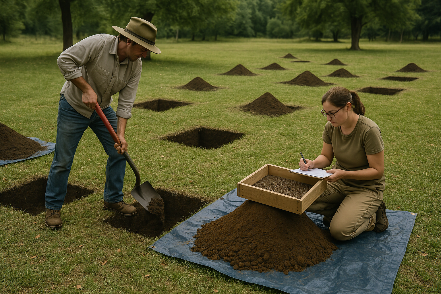
This is just in time as disasters like the fires at James Madison’s Montpelier Lab or at the Brazilian National Museumare not only destroying artifacts but also the decades of paper records that are the only existing records.

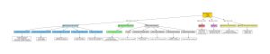
Back to Governmental Archaeology!  We wanted to talk about our LDU as a feature because it is directly addressing some of the issues that Governmental (and all) archaeological sectors are facing.  The image at the start of this post is a very rough breakdown of how just the US Governmental sector is structured. As we discussed in earlier posts, archaeology has grown pragmatically, usually where and when it is needed.  In the US, that means that archaeology is spread across at least 4 different Departments: Department of the Interior, Department of Agriculture, Department of Defense, and the Department of the Army.  From there it’s broken again into multiple smaller groups like the National Parks Service, Bureau of Land Management, Fish and Wildlife Services and about a dozen other departments and services across the government.

As part of this fragmented structure is also a fragmented database structure. The Federal Government has over a dozen different databases like the National Register of Historic Places, The National Historic Landmarks database, the HABS/HEAR/HALS (Building, Engineering, and Landscapes) databases and many more.  Before archaeologists in the commercial/CRM sector can begin working, they need to complete comprehensive checks of all of these databases to ensure that they are fully informed about what archaeology has been done at the Federal level and what might be in the way of a new road, railroad, water main, or other infrastructure. Federal archaeologists also complete any work on material that is found on Federal land.  It’s usually an archaeologist from the department that oversees that land but it can vary.

The State of Affairs

The problem gets worse as we drill down into the State archaeological process.  In addition to the Federal work that is done, following Federal laws, there are also State and Tribal Historic Preservation Offices (two separate entities – SHPO and THPO).  Each of these groups (a SHPO in all 59 States and Territories and a THPO in 42), will have their own standards, own databases, and their own expectations.

If an archaeologist is working in two States, for example between Pennsylvania and New York, they’ll need to work within the Federal and both State’s frameworks for archaeology.  This also means different standards for excavation and data collection.   A good example is a method called Shovel Test Pitting (STP), one of the most miserable jobs an archaeologist can do.  It is a method of surveying an area in the first phases of investigation to determine the density of artifacts and define site boundaries.  Unfortunately, this can range from dozens to hundreds of small holes an archaeologist needs to excavate, with paperwork for each hole and each site.  To make matters worse, the range of standards means that working in multiple States means multiple methods.  In New York, the standard for holes is generally no larger than 25 centimeters in diameter (or square) and at least 10 centimeters deep and should be done every 10 meters (5 meters depending on density). If you’re in Pennsylvania, it’s 50-centimeter squares or 57-centimeter diameter circular holes that should not extend more than 1 meter and this should be done every 15 meters (16 per acre).

For all archaeologists, these differences at the National, State, and even local levels creates a nightmare for recording and data standards. This is usually the case across the globe, our next post will be about the UK Governmental landscape. In every country, there are countless forms that need to be completed.

Tedious Paperwork

A large part of archaeology is simply paperwork and manual data entry.  It is common for the first 3-5 years of an archaeologist’s career to be nothing more than data entry and manual labor.  A lot of the work is nothing more than digging STPs, counting artifacts, and filling out the form, only to go back to the office and manually enter that information into a spreadsheet.  There are forms for everything in archaeology (usually still paper): Excavation Records, Feature Sheets, Survey Logs, Photo Registers, Stratigraphic Matrices, Context Sheets, Drawings, Sketches, Field Notebooks and more.  Most commercial companies will have their own forms which usually correspond to whatever basic standard is that they require to submit for record keeping or compliance.

The result is that there are hundreds of different forms that need to be manually entered into whatever system companies are using (Excel, Access, or a custom database).  Although, in many cases, the forms are the final product.  We’ll expand on this more in later posts but much of archaeological technology for recording has only been implemented in the past 10-15 years.  That means that there could be anywhere from 50-100 years of paper forms and other legacy data that is hidden away in closets or depots like those from Indiana Jones.

At ArchNova, we want to start pulling that data forward into the present and providing it as useful accessible data for the future.  We want to help organizations avoid natural disasters and situations that might destroy hundreds of years’ worth of history and archaeology.

Next week, we’ll jump into some of the UK governmental landscape and look at how ArchNova will be supporting compliance and regulation in different process flows.

Why Choose Us?

We harness the power of artificial intelligence to analyze and identify artifacts with speed and precision, transforming historical research. With our intelligent database, researchers and institutions can easily store, access, and analyze digital records.